|
|
Satellite
Constellation
The
Maxar's
Constellation
consists
of
six
high-resolution
satellites:
IKONOS
-
82
cm
panchromatic,
3.28
m
4-band
color
QuickBird
–
55
cm
panchromatic,
2.16
m
4-band
color
WorldView-1
–
50
cm
panchromatic
WorldView-2
–
46
cm
panchromatic,
1.85
m
8-band
color
GeoEye-1
–
41
cm
panchromatic,
1.65
m
4-band
color
WorldView-3
–
31
cm
panchromatic,
1.24
m
8-band
color
(31
cm after
February 15 2014)
| |
IKONOS |
QUICKBIRD |
WORLDVIEW-1 |
WORLDVIEW-2 |
GEOEYE-1 |
WORLDVIEW-3 |
| Available Products |
Geo, GeoStereo |
Basic, Standard, Ortho Ready Standard
and AOS |
Basic, Basic Stereo, Standard, Ortho
Ready Standard/Stereo and AOS |
Basic, Basic Stereo, Standard, Ortho
Ready Standard/Stereo and AOS |
Basic, Basic Stereo, Standard, Ortho
Ready Standard/Stereo and AOS |
Basic, Basic Stereo, Standard, Ortho
Ready Standard/Stereo and AOS |
| Spatila Resolution |
50 cm or 1m Pan, 3.2 m or 4 m MS |
60 cm Pan, 2.4 m MS |
50 cm Pan |
40 cm, 50 cm Pan 1..6m, 2.0 m MS |
40 cm, 50 cm Pan 1..6m, 2.0 m MS |
40 cm, 50 cm Pan 1..6m, 2.0 m MS |
| Multispectral Bands |
Red, Green, Blue, Near-Infrared 1 |
Red, Green, Blue, Near-Infrared
|
N/A |
Coastal, Blue, Green, Yellow, Red, Red
Edge, Near-Infrared 1 and Near-Infrared 2 |
Red, Green, Blue, Near-Infrared
|
Coastal, Blue, Green, Yellow, Red, Red
Edge, Near-Infrared 1 and Near-Infrared 2 |
| Native Accuracy (at nadir on flat
terrain) |
15 m CE90 |
23 m CE90 |
5 m CE90 |
5 m CE90 |
5 m CE90 |
TBD |
Satellite
Specification
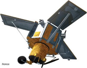
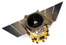
IKONOS:
The IKONOS
satellite is the world’s first commercial satellite to collect
panchromatic (black-and-white) images with .80 m resolution and
multispectral (color) imagery with 3.2-meter resolution. Imagery from
the panchromatic and multispectral sensors can be merged to create .80 m
color imagery (pan-sharpened). IKONOS imagery is being used for national
security, military mapping, air and marine transportation, and by
regional and local governments. From a 423-mile-high orbit, IKONOS has a
revisit time of once every three days and downlinks directly to more
than a dozen ground stations around the globe.
Specification:
|
Launch information |
Date: September 24,
1999
Launch vehicle:
Athena 2
Launch site:
Vandenberg Air
Force Base, California |
 |
|
Mission life |
12+ years |
|
Spacecraft size |
1.83 m x 1.57 m
(hexagonal configuration) |
|
Spatial resolution |
Panchromatic: 0.82
m
Multispectral:
3.2 m |
|
Positional
accuracy |
15 meter CE90
(specification)
9 meter CE90
(measured) |
|
Swath width |
11.3 km |
|
Off-nadir imaging |
Up to 60 degrees |
|
Dynamic range |
11 bits per pixel |
|
Revisit Time |
Approximately 3
days |
|
Orbital altitude |
681 km |
|
Nodal crossing
|
10.30 am |
|
Collection
capacity |
240,000 sqkm/day (Pan+MSI) |
QUICKBIRD
The
QuickBird satellite is the first to orbit Earth in Maxar’s
constellation. In April of 2011, Maxar completedan orbit
raise designed to extend the mission life of the QuickBird sensor.
An operational altitude of 482 km was achieved with an expected
gradual descent to 450 km by early 2013. Today, Maxar’s
QuickBird satellite offers sub-meter resolution imagery, high
geolocational accuracy, and large on-board data storage. With global
collection of panchromatic and multispectral imagery, QuickBird is
designed to support a wide range of geospatial applications.
|
Launch information |
Date: October 18, 2001
Launch vehicle:
Delta II
Launch site:
SLC-2W, Vanderberg Air Force Base, California |
 |
|
Mission life |
Extended through
early 2014 |
|
Spacecraft size |
2400 lbs, 3.04 m
(10 ft) in length |
|
|
Altitude 482 km |
Altitude 450 km |
|
Orbit |
Type:
Sun-synchronous,
10.00 am
descending node
Period: 94.2 min. |
93.6 min |
|
Sensor resolution |
Panchromatic:
65 cm GSD at nadir
Multispectral:
2.62 m GSD at
nadir |
Panchromatic:
61 cm GSD at nadir
Multispectral:
2.44 m GSD at
nadir |
|
Dynamic range |
11 bits per pixel |
|
Metric accuracy |
23 m CE90, 17 M
LE90 (without ground control) |
|
Swath width |
Nominal Swath
Width:
18.0 km at nadir |
Nominal Swath
Width:
16.8 km at nadir |
|
Retargeting
Agility |
Time to slew 200
km: 37 sec |
38
sec |
|
Dynamic range |
11 bits per pixel |
|
Revisit Time |
2.5 days at 1 m
GSD or less
5.6 days at 200
off-nadir or less |
2.4 days at 1 m
GSD or less
5.9 days at 200
off-nadir or less |
|
Attitude
Determination and Control |
Type: 3-axix
Stabilized
Star tracker/IRU/reaction
wheels, GPS |
|
Onboard Storage |
128 Gb capacity |
|
Collection
capacity |
200,000 sqkm/day |
WORLDVIEW-1
WorldView-1,
launched September 2007, is the first of our next-generation
satellites—the most agile satellites ever flown commercially. The
high-capacity, panchromatic imaging system features half-meter
resolution imagery. Operating at an altitude of 496 km, WorldView-1
has an average revisit time of 1.7 days and is capable of collecting
over one million km2 per day of half-meter imagery. The satellite is
also equipped with stateof-the-art geolocation accuracy capabilities
and exhibits stunning agility with rapid targeting and efficient
in-track stereo collection. WorldView-1 is currently on the move.
Over the course of two years the orbit will be adjusted to achieve a
descending node of 1:30pm.
|
Launch information |
Date: September 18,
2007
Launch vehicle:
Delta 7920 (9 strap-ons)
Launch site:
Vandenberg Air
Force Base, California |
 |
|
Mission life |
10-12 years,
including all consumables and degradable (e.g. propellant) |
|
Spacecraft size |
3.6 m (12 ft) tall
x 2.5 m (8ft) across
7.1 m (23 ft)
across the deployed solar arrays
2290 km (5038 lbs)
3.2 kw solar array
100 Ahr battery |
|
Spatial resolution |
Panchromatic only:
20 cm GSD at nadir |
|
Positional
accuracy |
Demonstrated <4.0
m CE90 without ground control |
|
Swath width |
17.7 km |
|
Attitude
Determination and Control |
3-axix stabilized
Actuators: Control
Moment Gyro (CMGs)
Sensor: Star
trackers, solid state IRU, GSP |
|
Dynamic range |
11 bits per pixel |
|
Revisit Time |
1.7 days at 1 m
GSD or less
5.4 days at 200
off-nadir or less (0.55 m GSD) |
|
Max Contiguous
Area Collected in a Single Pass (300 off-nadir
angle) |
Mono: 111x112 km
(6 strips)
Stereo: 51 x 112
km (3 Pairs) |
|
Retargeting
Agility |
Time to slew 200
km: 10 sec |
|
Onboard Storage |
2199 Gb solid
state with EDAC |
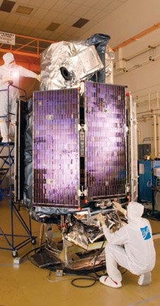
WORLDVIEW-2
WorldView-2, launched October 2009, is the first high-resolution
8-band multispectral commercial satellite. Operating at an altitude
of 770 km, WorldView-2 provides 46 cm panchromatic resolution and
1.85 m multispectral resolution. WorldView-2 has an average revisit
time of 1.1 days and is capable of collecting up to 1 million km2 of
8-band imagery per day, greatly enhancing Maxar’s
multispectral collection capacity for more rapid and reliable
collection. WorldView-2 substantially expands imagery product
offerings to all Maxar customers.
|
Launch information |
Date: October 8, 2009
Launch vehicle:
Delta 7920 (9 strap-ons)
Launch site:
Vandenberg Air
Force Base, California |
 |
|
Mission life |
10-12 years,
including all consumables and degradable (e.g. propellant) |
|
Spacecraft size |
5.7 m (18.7 ft)
tall x 2.5 m (8ft) across
7.1 m (23 ft)
across the deployed solar arrays
2615 kg (5765 lbs)
3.2 kw solar
array, 100 Ahr battery |
|
Spatial resolution |
Panchromatic only:
0.46 m GSD at nadir, 0.52 m GSD at 200 off-nadir
Multispectral:
1.85 m GSD at nadir, 2.07 m GSD at 200 off-nadir |
|
Geolocational Accuracy |
Demonstrated <3.5
m CE90 without ground control |
|
Swath width |
16.4 km |
|
Attitude
Determination and Control |
3-axix stabilized
Actuators: Control
Moment Gyro (CMGs)
Sensor: Star
trackers, solid state IRU, GSP |
|
Dynamic range |
11 bits per pixel |
|
Revisit Time |
1.1 days at 1 m GSD or less
3.7 days at 200
off-nadir or less (0.52 m GSD) |
|
Max Contiguous
Area Collected in a Single Pass (300 off-nadir
angle) |
Mono: 138 x 112 km
(8 strips)
Stereo: 63 x 112
km (4 Pairs) |
|
Retargeting
Agility |
Time to slew 200
km: 10 sec |
|
Onboard Storage |
2199 Gb solid
state with EDAC |
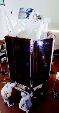
GeoEye-1
The
GeoEye-1 satellite is equipped with some of the most advanced
technology ever used in a commercial remote sensing system. The
satellite collects images at .41-meter panchromatic
(black-and-white) and 1.65-meter multispectral resolution. The
satellite can collect up to 350,000 square kilometers of
pan-sharpened multispectral imagery per day. This capability is
ideal for large-scale mapping projects. GeoEye-1 can revisit any
point on Earth once every three days or sooner.
|
Launch information |
Date: September 6, 2008
Launch vehicle:
Delta ll
Launch site:
Vandenberg Air
Force Base, California |
 |
|
Mission life |
Expected >10 years |
|
Spacecraft size |
4186 lbs, 4.34 m
in length |
|
Spatial resolution |
Panchromatic only:
0.41 m GSD at nadir
Multispectral:
1.65 m GSD at nadir |
|
Geolocational Accuracy |
5 m CE90, 3 m CE90
(measured) |
|
Swath width |
Nominla Swath
Width: 15.3 km at nadir |
|
Attitude
Determination and Control |
Type: 3-axix stabilized
Star tracker/IRU/reaction
wheels, GPS |
|
Dynamic range |
11 bits per pixel |
|
Revisit Time |
2.6 days at 300
off-nadir |
|
Retargeting
Agility |
Time to slew 200
km: 20 sec |
|
Capacity |
350,000 km2/day
Multi-spectral |
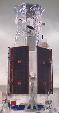
WORLDVIEW-3
Introducing WorldView-3, the first multi-payload, super-spectral,
high-resolution commercial satellite. Operating at an expected
altitude of 617 km, WorldView-3 provides 31 cm panchromatic
resolution, 1.24 m multispectral resolution, 3.7 m short-wave
infrared resolution, and 30 m CAVIS resolution. WorldView-3 has an
average revisit time of <1 day and is capable of collecting up to
680,000 km2 per day, further enhancing the Maxar collection
capacity for more rapid and reliable collection. Launching in 2014,
the WorldView-3 system will allow Maxar to further expand its
imagery product offerings.
|
Orbit |
Attitude: 617 km
Type: Sunsync, 1:30 pm descending Node
Perion: 97 min |
 |
|
Mission life |
Spec Mission Life:
7.25 years
Estimated Service
Life: 10 to 12 years |
|
Sensor Resolution
(or GSD) |
Panchromatic
Nadir:
200
off-nadir:
Multispectral
Nadir:
200
off-nadir:
SWIR Nadir:
200
off-nadir:
CAVIS Nadir: |
0.31 m
0.34 m
1.24 m
1.38 m
3.70 m
4.10 m
30.00 m |
|
Dynamic Range |
100-bits per pixel
Pan and MS; 14 bits per pixel SWIR |
|
Swath Width |
At nadir: 13.0 km |
|
Attitude
Determination and Control |
3-axix stabilized
Actuators: Control
Moment Gyro (CMGs)
Sensor: Star
trackers, solid state IRU, GSP |
|
Pointing Accuracy |
Accuracy: <500 m
at image start/stop
Knowledge:
Supports geolocation accuray below |
|
Retargeting
Agility |
Time to Slew 200
km: 12 sec |
|
Onboard Storage |
2199 Gb solid
state with EDAC |
|
Max Contiguous
Area Collected in a Single Pass (300 off-nadir
angle) |
Mono: 66.5 x 112
km (5 strips)
Stereo: 26.6 x 112
km (2 Pairs) |
|
Revisit Frequency
(at 400N Latitude) |
Predicted >3.5 m
CE90 without ground control |
|
Capacity |
680,000 km2
per day |
|